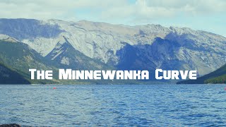

Testing Flat Earth at a Canadian Lake
45sControversial topic with high curiosity and visual setup draws viewers into the experiment.
▶ Play Clip"Delivers exactly what the title promises: a detailed curvature test with full methodology."
This video presents a detailed, scientific curvature experiment conducted at Lake Minnewanka, Alberta, to test the assumption that the Earth is a convex sphere with a radius of approximately 6,371 km. The creator uses precise measurements, camera setups, and calculations to demonstrate observable occlusion at a distance of 7 km, providing evidence against flat Earth claims.
The video is a companion to the documentary 'In Search of a Flat Earth', focusing on a curvature test at Lake Minnewanka.
Used Blackmagic Pocket 4K in 2.6k 16mm sensor crop mode, assuming 12.5mm x 7mm sensor area. Primary footage at 120 fps, 180° shutter.
Southwest bank of Minnewanka near SCUBA access, looking northeast towards Aylmer canyon, distance of almost exactly 7 km.
Used Google Streetview and tour boat (height ~3m) as references. Elevation gain from water to forest up to 1m.
Tamron FD zoom lens at 288mm, FOV 2.48°, field width at 7km ~302m. Confirmed with satellite maps.
Camera on jib: maximum elevation 1.5m, minimum ~10cm, to test convex sphere assumption.
Cites Dizzib's online calculator. Used Pythagoras to compute horizon dip and occlusion height.
At 7km, occlusion ranges from 0.54m at peak to 2.7m at nadir, delta of 2.2m, which corresponds to 1.3% of image height (170m field).
Motion comparison and known objects (tour boat) support Earth as convex sphere with radius ~6,371 km.
The experiment provides clear empirical support for Earth's curvature, with measurable occlusion consistent with a spherical model of radius 6,371 km.
What camera was used for the curvature experiment?
Blackmagic Pocket 4K in 2.6k 16mm sensor crop mode.
00:15
What was the distance from the camera to Aylmer canyon?
Almost exactly 7 km.
01:02
What is the assumed Earth radius used in the calculations?
6,371 km.
02:54
What lens focal length was used for the primary test?
288 mm (Tamron FD zoom).
02:26
What is the formula for distance to horizon (d1)?
d1 = sqrt(H0^2 + 2*R*H0).
03:23
What was the expected occlusion delta between peak and nadir?
2.2 m.
03:53
What percentage of image height does 2.2 m represent at 7 km?
1.3%.
04:06
Mathematical Model from Dizzib
Provides reproducible calculations for horizon dip and occlusion, enabling others to replicate the experiment.
03:09Motion Comparison with Known Objects
Uses real-world objects (tour boat) to validate predictions, strengthening empirical evidence.
04:18High-Frame-Rate Footage
Recording at 120 fps maximizes detail for analyzing subtle occlusion changes.
00:32[00:00] Hello everyone, this video is a companion piece to the documentary In Search of a Flat Earth. n this video I’m going to cover the curvature experiment I did for that video at Lake Minnewanka, Alberta, and I'll go a bit slower, cover all the details, and include a lot more footage.
[00:15] will include most of the footage from the test itself, lightly trimmed for viewability. All the relevant footage for this project was recorded using the Blackmagic Pocket 4K in its 2.6k 16mm sensor crop mode.
[00:32] For the purpose of field of view calculations we’ll be assuming a sensor area of 12.5mm by 7mm. Additionally the primary test footage was shot at 120 frames per second to maximize detail, with a shutter speed of 180°,
[00:47] resulting in an exposure interval of 4 milliseconds. For this experiment we are standing on the southwest bank of Minnewanka, right near the SCUBA access, looking northeast towards Aylmer canyon, a distance of almost exactly 7km.
[01:02] Just to get a sense of what we will be looking at, here is what the location looks like on the Google Streetview from the tour boat. And here is footage of the shoreline from the beach looking west down the coast.
[01:19] We’re on a 16mm lens here giving us a horizontal field of view of 42.5° and a vertical of 24.68°. Comparing the resulting image with a 42.5° arc overlaid on satellite images confirms this.
[01:36] With that we can then look at other footage of the north shore and compare relative sizes, particularly towards the mouth of Aylmer canyon, with an elevation gain of up to 1 metre from the water’s edge to the forest.
[01:53] As another point of reference, here is the Minnewanka tour boat, seen at a distance of approximately 1km. Using the depth markings on the side of the boat as a reference, we can confirm that the height of the boat from the water’s surface to the top of the rear canopy is around 3 metres,
[02:09] with the distinct blue/green canopy being approximately 1.5 metres tall at the front of the boat, For the primary test we used an old Tamron FD zoom lens with an operational focal length of 288mm confirmed in controlled tests.
[02:26] This gives us a field of view of 2.48°, with a field width at a distance of 7km of about 302m. against satellite maps, both place them 150m apart.
[02:42] With this confirmed we can thus confidently operate off a field height of 170m at the plane of the beach. With the camera mounted on the jib the maximum useful elevation above the water’s surface is
[02:54] around 1.5 metres, with the minimum elevation being approximately 10 centimetres. allowing us to test the assumption that the earth is a convex sphere with a radius of 6,371km.
[03:09] Credit to github user Dizzib who has compiled all this math into a convenient online calculator. The two variables we are interested in are the distance to the local horizon, d1,
[03:23] Using Pythagoras D1 = root H0 squared + 2 R H0 And H1 equals root D0 minus D1 squared plus R squared minus R
[03:40] This may seem intimidating at first glance, but at the core we’re just solving two right-angle triangles. we should expect to see the occlusion at a distance of 7km
[03:53] go from 0.54m at the peak to 2.7m at the nadir, a delta of 2.2m. Using our field height calculation of 170m,
[04:06] 2.2m elevation should correspond to 1.3% of the image height, And then in motion, comparing the change in visibility between peak and nadir
[04:18] with this space and known-objects, notably the tour boat, supporting the assumption that the earth is a convex sphere with a radius of approximately 6,371 km.
[04:33] [chill music]




⚡ Saved you 0h 28m reading this? Transcribe any YouTube video for free — no signup needed.